Paris Trees and Gardens worksheet on MongoDB
The context
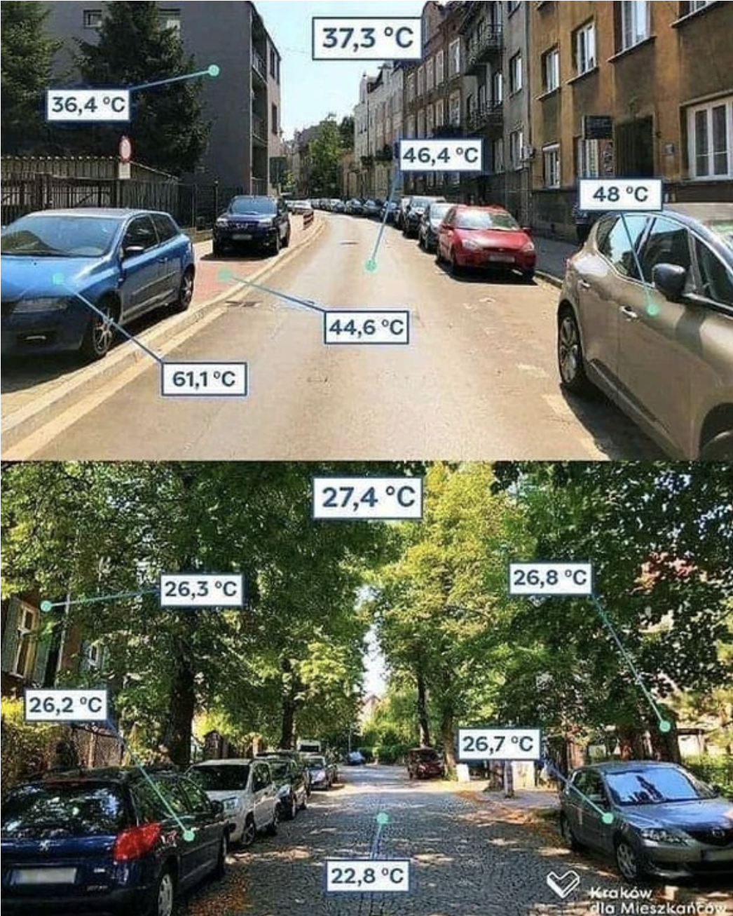
Trees are a huge asset in the path to resilience with regard to climate change.
The city of Paris has a strong policy to leverage trees in its strategy to lower the temperatures during heat waves.
- “The city has set itself the goal of de-bituminizing 100 hectares and planting 170,000 trees between 2020 and 2026.” from Climate change resilience (fr)
- see also “The tree plan” document https://cdn.paris.fr/paris/2021/12/13/daf6cce214190a66c7919b34989cf1ed.pdf
 from this article
You want to launch a new app where people can find shade in the event of a heat wave. Given a user location, the app finds the closest Green Space with the largest amount of trees.
You have an important meeting next week with the Paris team in charge of trees where you want to demonstrate a POC (proof of concept) of your new app.
Fortunately, there is a couple of datasets available on the Paris open data platform that you can leverage
- The Paris Tree dataset that includes over 210k trees in and around Paris.
- The Espaces verts dataset (green spaces) with over 2300 areas.
These are real world datasets and as such have their share of anomalies. In this practice, we will use modified versions of these 2 datasets.
In today’s workshop you will:
- load both datasets into MongoDB collections
- write aggregation pipelines to explore the datasets and weed out anomalies
- practice creating schema validators
- learn to use GeoJSON
- identify trees within a greenSpace
Submissions
To submit your answers go to the answers form on https://forms.gle/iEjXSezcskFr8iQo7
Fill in your epita email and your name
Datasets
You have 2 main datasets available greenspaces and trees in multiple versions
A
jsonfile contains an array of documents, while andjsonfile contains one document per line.
- extracts 100 rows (JSON)
- full datasets (JSON)
- full datasets (NDJSON)
If you struggle importing the full datasets, you can still work with smaller versions that only include a few samples:
- 100 samples:
trees_100.json.zip,greenspaces_100.json.zip
Tree sample
Here’s a random sample of the trees dataset
{
    "idbase": 121837,
    "domain": "Jardin",
    "stage": "Adulte",
    "height": 12,
    "circumference": 290,
    "location": {
        "id_location": "103006",
        "address": "JARDIN DE L HOSPICE DEBROUSSE / 148 RUE DE BAGNOLET",
        "arrondissement": "PARIS 20E ARRDT"
    },
    "geo": {
        "geo_point_2d": "48.86213187971267, 2.406612673774295"
    },
    "taxonomy": {
        "name": "If",
        "species": "baccata",
        "genre": "Taxus"
    }
}
Not all the fields are present in that sample. For instance, some trees also have a taxonomy.variety field.
Also Note that the geo location value geo_point_2d is a string. We will have to convert it into a Point data type using an aggregation pipeline
Garden sample
Here’s a sample of the garden dataset
{
    "nom": "JARDINIERES EVQ DE LA RUE WALDECK-ROUSSEAU",
    "typologie": "Décorations sur la voie publique",
    "categorie": "Jardiniere",
    "nombre_entites": 4.0,
    "id": {
        "id_division": 117.0,
        "id_atelier_horticole": 34.0,
        "ida3d_enb": "JDE13017",
        "site_villes": "SV",
        "id_eqpt": "13017"
    },
    "location": {
        "adresse_numero": 1.0,
        "adresse_type_voie": "RUE",
        "adresse_libelle_voie": "WALDECK ROUSSEAU",
        "code_postal": 75017
    },
    "surface": {
        "superficie_totale_reelle": 45.0,
        "surface_horticole": 45.0
    },
    "history": {
        "annee_de_ouverture": 2024.0
    },
    "geo": {
        "geo_shape": {
            "coordinates": [
                [
                    [
                        [
                            2.286545191756581,
                            48.88003700060801
                        ],
                        // ...
                    ]
                ],
                [
                    [
                      // ...
                    ]
                ]
            ],
            "type": "MultiPolygon"
        },
        "geo_point": "48.87986720205693, 2.2864491642985567"
    }
}
Visually checking a tree with google maps
As you will see some trees have anomalies in their measurements. The max height is 2524 meters and the max circumference is 80105 cm. This is most probably a human error.
For some dimensions, it is less obvious if the measure is an anomaly or if the tree is really that high or that big.
In that case, it is possible to visually check if a tree has the dimensions indicated in the dataset. Just search for the latitude and longitude (from the geo_point_2d field) on google maps and check out the street photos.
For instance this tree is supposed to have circumference: 1650 (16.5m) but the photo shows only normal sized Platanes.
Setup
All queries and instructions in this document are done in the terminal with mongosh.
If you prefer to work with Mongo Compass, directly in ATLAS or using a driver (python, node.js, etc …) please do so.
This work not about scripting it’s about writing MongoDB aggregation pipelines and queries. Feel free to use the best tool available for you.
Local installs
You can work on your local after installing mongo and mongosh.
To check if mongoimport is already installed on your local, do mongoimport --version. If it returns the version you’re fine, otherwise you must install it.
See this page to download command line utilities. The list of utilities is here. It includes mongoimport, mongoexport. see also mongostat and mongotop as diagnostic tools.
ATLAS cluster
You can connect from your local to an ATLAS free-tier cluster.
Atlas free tier clusters offer 512Mb for storage. However, if the current ATLAS free-tier cluster does not have enough space, you should delete it and create a new one that has no data.
Connect
Assuming you’ve set your MongoDB password as an environment variable MONGODB_PASSWORD, you can connect with
mongosh "mongodb+srv://<username>:${MONGODB_PASSWORD}@<server_uri>/"
or simply set the whole URI as an environment variable and connect with
mongosh ${MONGO_ATLAS_URI}
This connects you to the default test database.
Section 1: load the data
Create a new database
Start by creating a new database, let’s call it treesdb.
In MongoDB, to create a new database you simply use it
use treesdb # this creates the database
Here are a few examples of useful MongoDB instructions.
- list databases on the cluster
You can check that the database has been created with show dbs
Atlas atlas-2914eu-shard-0 [primary] test> show dbs
admin  348.00 KiB
local    8.47 GiB
- Create a
treescollection with
db.createCollection("trees")
- drop a database with
dropDatabase()
To drop a database, first use it use sample_mflix and then you can drop it db.dropDatabase('sample_mflix'). You cannot drop a database that is not the current one.
- Empty a collection with
deleteMany()
db.trees.deleteMany({})
- delete a collection with
drop()
db.trees.drop()
- check the content of a collection with
stats()
db.trees.stats()
Here is a good MongoDB cheatsheet for other instructions.
Let’s load the data
A few remarks before you get started:
- First you need to download the data from the github into your local and unzip the files
- In the following we assume that the data files are in the current folder
./. Modify with your own path. - Since loading the whole dataset may take awhile, it’s best to work on a 1k or 100 sample subset. All examples below use the 1k trees subset.
We have several options to load the data from a JSON file. Either in mongosh with insertMany() or from the command line with mongoimport.
In mongosh with insertMany()
The following script
- loads the data from the
trees.jsonfile - Insert data into the
treescollection withinsertMany() - times the operation
// load the JSON data
const fs = require("fs");
const dataPath = "./trees_1k.json"
const treesData = JSON.parse(fs.readFileSync(dataPath, "utf8"));

// Insert data into the desired collection
let startTime = new Date()
db.trees.insertMany(treesData);
let endTime = new Date()
print(`Operation took ${endTime - startTime} milliseconds`)
Using mongoimport command line
mongoimport is usually the fastest option for large volumes.
By default mongoimport takes a ndjson file (one document per line ) as input. But you can also use a JSON file (an array of documents) if you add the flag --jsonArray.
The overall syntax for mongoimport follows:
mongoimport --uri="mongodb+srv://<username>:<password>@<cluster-url>" \
--db <database_name> \
--collection <collection_name> \
--file <path to ndjson file>
Here are other interesting, self explanatory, flags that may come in handy:
--mode=[insert|upsert|merge|delete]--stopOnError--drop(drops the collection first )--stopOnError
In our context, here is a version of the command line, using the MONGO_ATLAS_URI environment variable and loading the JSON file trees_1k.json in the current folder.
time mongoimport --uri="${MONGO_ATLAS_URI}" \
--db treesdb  \
--collection trees \
--jsonArray \
--file ./trees_1k.json
which results in
2024-12-13T11:41:45.941+0100 connected to: mongodb+srv://[**REDACTED**]@skatai.w932a.mongodb.net/
2024-12-13T11:41:48.942+0100 [########################] treesdb.trees	558KB/558KB (100.0%)
2024-12-13T11:41:52.087+0100 [########################] treesdb.trees	558KB/558KB (100.0%)
2024-12-13T11:41:52.087+0100 1000 document(s) imported successfully. 0 document(s) failed to import.
mongoimport --uri="${MONGO_ATLAS_URI}" --db treesdb --collection trees  --fil  0.15s user 0.09s system 3% cpu 6.869 total
Q1.1 Write down your import command
Write down your mongoimport command as the 1st answer to the 1st question on the quiz
Load the green spaces dataset
Load now the greenspaces.json dataset into a new greenSpaces collection in the treesdb database.
In mongosh:
use greenSpaces
Then in the terminal:
time mongoimport --uri="${MONGO_ATLAS_URI}" \
--db treesdb  \
--collection greenSpaces \
--jsonArray \
--file ./greenspaces.json
Check that the import worked with show collections and db.greenSpaces.countDocuments() which should return a total of 2313 documents.
And now load the entire trees dataset
If you are able to load the 1k sample file, you should now load the entire dataset. This takes a few minutes.
Make sure you first remove all existing documents from the current treesdb database with db.trees.deleteMany({}).
Then import the whole dataset from the trees.json or the trees.ndjson file. (unzip first of course)
Note: you don’t need to wait for the whole trees dataset to be loaded. You can proceed with the questions while the dataset loads.
Section 2: Data Exploration
In this section, you write aggregation pipelines to explore the trees dataset.
Q2.1 Count trees per domain
This is equivalent of the SQL
select count(*) as n, domain from trees group by trees order n desc
Write the aggregation pipeline to count trees per domain, order by most common domains first.
Hint: use the $group and $sort operators.
The most common domain is Alignments and the least common one is DAC (not clear what DAC refers to).. You should obtain 48256 Alignments and 33 for DAC.
Q2.2 Count the number of trees per stage
The distinct function db.trees.distinct('stage') returns 4 values: [ 'Adulte', 'Jeune (arbre)', 'Jeune (arbre)Adulte', 'Mature']. However, the stage field is often missing from the trees documents.
Write the aggregation pipeline to count the number of trees per stage for all values as well as number of trees with missing stage (null values), order by descending.
Optional: using $ifNull, you can specify a string value for null.
{
  $ifNull: ["$stage", "MISSING"] // Use "MISSING" as a placeholder for missing 'stage'
},
Q2.3 Dimensions of trees per stage
Let’s calculate some stats on the dimensions of the trees in the database according to their stage.
Group the trees by stage and calculate the count, min, max and average height and circumference of trees.
- Exclude trees where the stage is missing.
- use
$projectand the$roundoperators to round up the average to 2 decimals - sort by average height descending
Q2.4 Count remarkable trees
Some trees are flagged with the field remarkable. If the field is present it has the value ‘OUI’, otherwise the field is simply missing.
Write the query that counts how many trees are remarkable using countDocuments() and the $exists operator. ‘OUI’.
Q2.5 What makes a tree remarkable ?
We would assume that remarkable trees are special because of their dimensions. Let’s verify that assumption.
Write an aggregation pipeline that compares the average height and circumference of trees that are remarkable with ones that are not. What do you conclude, was our assumption correct?
In the aggregation pipeline:
- only consider Platane trees (add
"taxonomy.name" : "Platane"in the$matchclause) - then exclude trees that have zero height or zero circumference
- and exclude trees that are higher than 100m or with a circumference > 500cm
- finally, only consider mature trees (stage = ‘Mature’)
- don’t forget to round up the average height and circumference to 2 decimals. (
$projectand$round)
The output should show
remarkable(OUI ornull)countavgHeightavgCircumference
Q2.6 Top 5 names of trees
What are the most common trees in Paris ?
Write the aggregation pipeline that returns the names of the top 5 most common trees names (taxonomy.names) in Paris
Q2.7 Calculate the age of the trees
The age of a tree is highly correlated to its circumference. The relation between age and circumference depends on many factors including the tree species. Here we use a very simplified rule where the age is the circumference divided by π.
age in years = Circumference in cm / π
We want not only to calculate the age of each tree with but also add that number to a new field age to the collection.
2 operators are available for that :
$addFields: Only adds new fields, preserves existing ones- $setField (alias $set): Can both add new fields AND modify existing ones
However, both operators only work on the current aggregation pipeline. They do not make persistent changes to the collection. For that you need to use the updateMany() function instead of an aggregation pipeline.
see this page and this one for the documentation and examples on using updateMany()
To check that the age field has been created, run db.trees.countDocuments({age : {$exists: true}})
Q2.8 how many greenSpaces are gardens?
Let’s now explore the greenSpaces dataset
We want to check how many of these green spaces are gardens.
Write the aggregation pipeline to count the number of each categorie from the greenSpaces collection
Among other categories, we have 19 Parcs, 2 Terrain de boules, 341 Murs vegetalises and 212 Jardins.
For the sake of curiosity also check the different typologie.
Q2.9 is perimetre available for all categories and topologies of greenSpaces ?
We want to see if all categories and typologies of greenSpaces have a perimeter.
Write the aggregation pipeline that counts the number of greenSpaces that have a perimeter per category and typology
Q2.10 Sample 5 greenSpaces at random
Looking at random samples of a collection is often a good way to get acquainted with the data.
Using the $sample operator, write the aggregation pipeline that returns 5 randomly selected Green Spaces.
Section 3 : Schema Validation
At this point you have a better understanding of the datasets and you are comfortable writing aggregation pipelines.
The next step is to make sure the data in the database is clean. For that we will create the collection before importing the data and specify what sort of data can be added to the collection.
Schema Validation
First please familiarize yourself with schema validation in MongoDB with this document: Schema validation. See this documentation for a more in depth presentation
We create the collection before importing the data with the function db.createCollection(name, options).
The syntax for create collection can be found here
Here is a shorter version :
db.createCollection( <name>,
    {
      validator: <document>,
    }
  )
The validator option takes a document that specifies the validation rules or expressions.
Check out this example:
db.createCollection("students", {
   validator: {
      $jsonSchema: {
         bsonType: "object",
         title: "Student Object Validation",
         required: [ "address", "major", "name", "year" ],
         properties: {
            name: {
               bsonType: "string",
               description: "'name' must be a string and is required"
            },
            year: {
               bsonType: "int",
               minimum: 2017,
               maximum: 3017,
               description: "'year' must be an integer in [ 2017, 3017 ] and is required"
            },
            gpa: {
               bsonType: [ "double" ],
               description: "'gpa' must be a double if the field exists"
            }
         }
      }
   }
} )
Q3.1 Write a trees schema validator
Your task is to write a validator that requires
height < 50circumference < 500- required
taxonomy.nameandgeo.geo_point_2d validationAction: "error"
and use it in the db.createCollection("trees", {<validator>}) function
Note: Before you import the data with mongoimport or with db.trees.insertMany(), don’t forget to empty the collection db.trees.deleteMany({}) or to drop it db.trees.drop() between each run.
Q3.2 Compare validationAction: error and warn
Your task: using mongoimport on the 1k sample dataset trees_1k.json
- drop the trees collection
- import the dataset with validationAction: “error”, and validationAction: “warn”.
Write down your observation and conclusion.
Q3.3 Remove geolocation duplicates
Besides crazy heights and absurd circumferences, the dataset also holds geolocation duplicates. Some trees have the same exact latitude and longitude.
Write the aggregation pipeline that finds all the trees that share the same geolocation.
You should find 18 trees (9 pairs) that share the same geolocation if you are working with the the 1k or the whole dataset. (the dataset is designed so that duplicates show as the first documents )
Q3.4 Create a unique index
The best way to avoid duplicates is to add a unique index.
- drop the collection and recreate it with the validator
- add a unique index on the
geo.geo_point_2dfield
db.trees.createIndex({ "geo.geo_point_2d": 1 }, { unique: true })
Check that index exists with db.trees.getIndexes().
Write down the output of db.trees.getIndexes()
Now reimport the trees_1k data
You should see messages like this one during the import.
2024-12-08T12:12:32.561+0100 continuing through error: E11000 duplicate key error collection: trees_flat_db.trees index: geo_point_2d_1 dup key: { geo_point_2d: "48.85002871626844, 2.3979943882939807" }
Now once you’ve re imported the data, if you rerun the aggregate pipeline that detects duplicates geolocations, it should return nothing.
Load the whole dataset then take a break
Load the whole dataset
but first:
- drop the
treescollection - recreate the
treescollection with the validator - create the unique index on
geo.geo_point_2d - load the whole dataset with mongoimport using
trees.jsonortrees.ndjson
This takes around 10 mn. Take a break
At the end you should see:
2024-12-08T12:44:27.147+0100 169120 document(s) imported successfully. 1231 document(s) failed to import.
Once that is done you should clone the collection so that if anything breaks you do not have to reload the whole dataset
Cloning the collection
You can do so with
db.trees.aggregate([
   { $match: {} },  // This matches all documents
   { $out: "trees_backup" }  // Creates a new collection named trees_backup
])
If you need to restore the trees_backup collection, simply drop the trees collection and use the same statement.
Section 4: GeoJSON
GeoJSON is a format for encoding geographic data structures. Key points:
- Uses JSON syntax
- Basic types: Point, LineString, Polygon, MultiPoint, MultiLineString, MultiPolygon
- Coordinates in [longitude, latitude] order
- Example Point:
{
  "type": "Point",
  "coordinates": [2.3522, 48.8566]  // Paris coordinates
}
geoJSON is used widely in mapping applications and spatial databases like MongoDB
see geoJSON in MongoDB for reference
Note: contrary to common usage where latitude comes before longitude, geoJSON points have the longitude first and the latitude second
Once we have a geoJSON point for each tree, we can find all the trees within 100 meters of the Eiffel tower with the $near operator.
db.trees.find({
  location: {
    $near: {
      $geometry: {
        type: "Point",
        coordinates: [2.294694, 48.858093]  // Eiffel Tower coordinates
      },
      $maxDistance: 100  // in meters
    }
  }
})
We can also use the $geoNear operator:
db.trees.aggregate([
  {
    $geoNear: {
      near: {
        type: "Point",
        coordinates: [2.294694, 48.858093]
      },
      distanceField: "distance",
      spherical: true,
      query: { "genre": "Tilia" }  // Only Linden trees
    }
  }
])
The geo.geo_point_2d field in the database is just a string with <latitude>,<longitude>. Let’s convert it to GeoJSON format. This will allow us to find the trees near a specific geolocation.
In this section, you will
- convert string to geojson
- find your address lat and long
- given location find number nearest trees
- do you have a remarkable tree in the vicinity?
Q4.1 Convert the geo_point_2d string into an array of strings
We want to convert the geo_point_2d string <lat>, <long> into a geoJSON point.
Start by converting the string into an array of floats, and swap the coordinates.
Write an aggregation pipeline that splits the geo_point_2d field into an array of 2 numbers while swapping the coordinates.
Hint: use the following operators
$addFieldsto create a new field$splitto split the string with respect to the comma,$convertto convert a string to double (float)arrayElemAt(array, n)to get the nth element from an array
You can also use the $let operator to create temporary variables within an expression.
$let: {
  vars: { /* define variables here */ },
  in: /* use variables here with $$varname */
}
Q4.2 Convert the array of floats into a Point
Let’s expand on that pipeline and now cast the array of floats into a Point.
Make sure
- the new field is nested in the
geofield - name the new field :
geo_point
Write the aggregation pipeline that will include the new field in the geo field as such:
{
  geo: {
    geo_point_2d: '48.837794432065046, 2.3777788022073083',
    geo_point: {
      type: 'Point',
      coordinates: [ 2.3777788022073083, 48.837794432065046 ]
    }
  }
}
Q4.3 Make the new field permanent
If you’ve used $addfields, the new field is created on the fly and not saved as permanent in the collection. (db.trees.findOne() won’t return the new field).
Write the statement using $set and $updateMany() that actually adds the new field into the collection.
check the geo_point field
Check that everything is as expected. The db.trees.findOne() command should return something similar to
{
  _id: ObjectId('675ea31285f935714045b298'),
  idbase: 2041515,
  domain: 'Jardin',
  stage: 'Jeune (arbre)',
  height: 5,
  circumference: 50,
  location: {
    id_location: '101002',
    address: 'SQUARE ERNEST GOUIN / 19 RUE EMILE LEVEL',
    arrondissement: 'PARIS 17E ARRDT'
  },
  geo: {
    geo_point_2d: '48.89391877343201, 2.317941722152433',
    geo_point: {
      type: 'Point',
      coordinates: [ 2.317941722152433, 48.89391877343201 ]
    }
  },
  taxonomy: { name: 'Saule', species: 'sp.', genre: 'Salix' }
}
Q4.4 convert gardens geolocation
The greenSpaces collection also has a geo_point as a string of <lat>, <long>.
Write the updateMany() statement that will transform the greenSpaces.geo.geo_point into a geoJSON type.
Add a geo spatial index
before we can run geo queries we need to add a geo spatial index
db.trees.createIndex({ "geo.geo_point": "2dsphere" })
db.greenSpaces.createIndex({ "geo.geo_point": "2dsphere" })
Find the number of trees in the vicinity of an address
Now let’s take an address
You can find the related longitude and latitude using google maps. just click right on the red pin
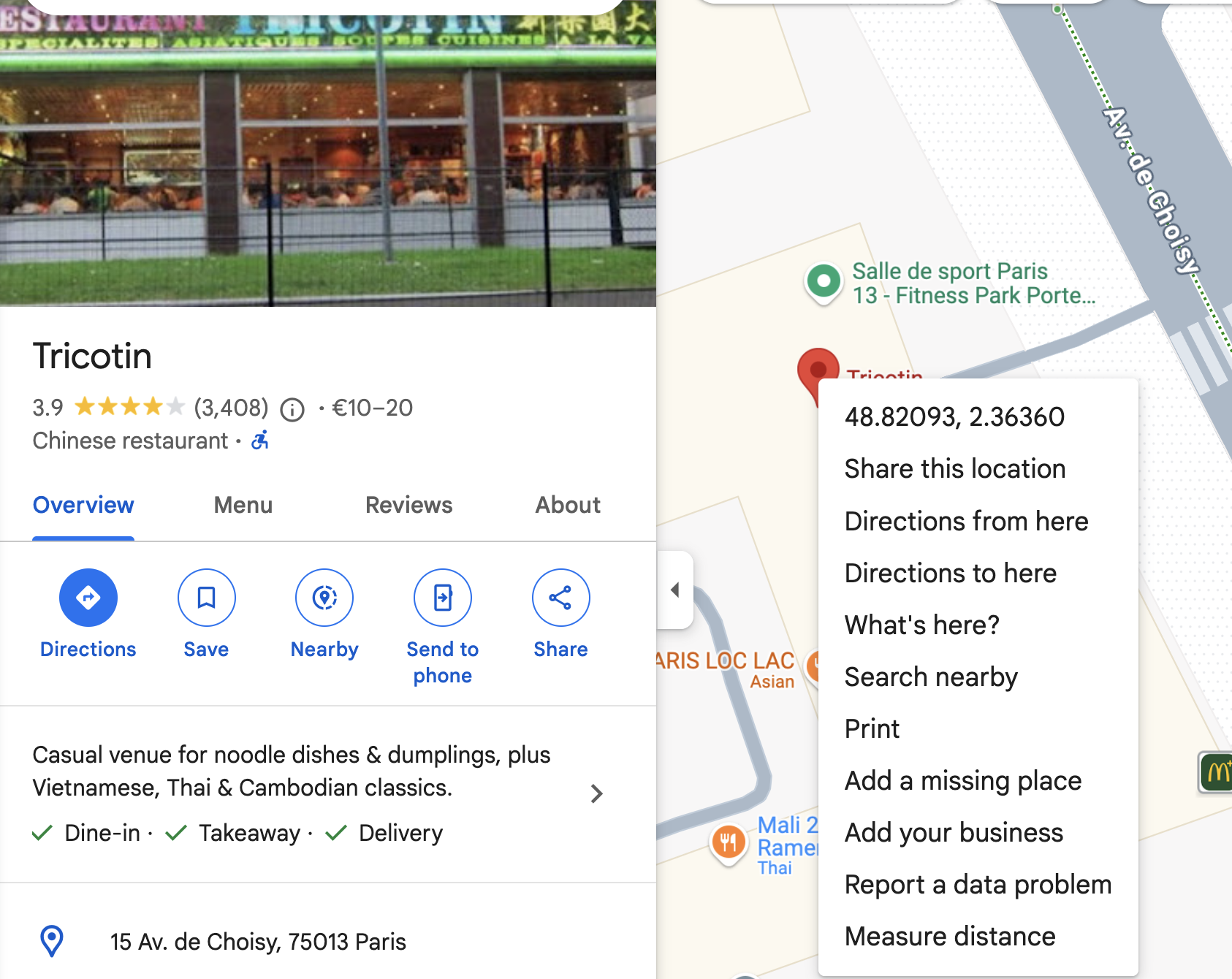
You get for instance : 48.82124804336634, 2.363645912660704
Let’s find the number of trees around this address, in a radius of 50m
// Find how many trees are within 100 meters of Tricotin
db.trees.find({
  location_geojson: {
    $near: {
      $geometry: {
        type: "Point",
        coordinates: [2.363645912660704, 48.82124804336634]  // Tricotin coordinates
      },
      $maxDistance: 100  // in meters
    }
  }
}).count()
What about Epita ? with coordinates 2.362806368481762, 48.815820795886815
// Find how many trees are within 100 meters of Epita
db.trees.find({
  location_geojson: {
    $near: {
      $geometry: {
        type: "Point",
        coordinates: [2.362806368481762, 48.815820795886815]  // Epita coordinates
      },
      $maxDistance: 100  // in meters
    }
  }
}).count()
only 11 trees!
What about your own address ?
Q4.5 Most common trees in an area
Write the aggregation pipeline that returns the top 5 most common tree name in the vicinity of a particular garden
You can set the greenspace name as a variable
For instance:
let greenspace_name = 'SQUARE EMILY DICKINSON'
let radius = 100
You need to write one query and one pipeline
- the query finds the greenSpace with the name
- the pipeline uses
$geoNearon the trees collection with the retrieved point.
Q4.6 find if a tree belongs to a garden
- Find the greenSpace with categorie ‘Jardin’ an typologie ‘Jardins privatifs’ and the largest surface_calculee.
- store the document in a variable (jardin)
- Create a 2dsphere index on greenSpaces.geo.geo_shape
- check that the index has been created
- Write the pipeline to find how many trees are in this Jardin
- using the
$geoIntersectsoperator
- using the
let jardin = db.greenSpaces.aggregate([
  {
    // Step 1: Filter green spaces with the 'Jardin' category
    $match: {
      categorie: "Jardin",
      typologie: "Jardins privatifs"
    }
  },
  {
    // Step 2: Sort by 'surface_calculee' in descending order
    $sort: {
      "surface.surface_calculee": -1
    }
  },
  {
    $project: {
      nom: 1,
      typologie: 1,
      categorie: 1,
      surface :1 ,
      geo: 1,
    }
  },
  {
    // Step 3: Limit to the top result (the largest surface_calculee)
    $limit: 1
  }
]);
const geoShape = jardin.geo.geo_shape;

const treesInShape = db.trees.find({
  "geo.geo_point": {
    $geoWithin: {
      $geometry: geoShape
    }
  }
});
Q4.7 add a tree_count field for all green spaces
Now write the updateMany() statement to add a tree_count new field to all the green spaces documents where tree_count counts the number of trees from the trees collection that are in the green space geo shape
Q4.8 Include trees in the greenSpaces collection
In the greenSpaces collection, add the list of trees in the garden as an array.
Only list the height, circumference, and taxonomy (name, species, genre, variety) of the tree.
Conclusion
Now, given a green space, we can easily list all the trees and their dimensions in that green space.
You can more easily build an app on top of that collection to display trees on any Paris Green Space. And since you have the geoJSON geo location of each green space, a user can find the closest place with the highest number of trees to get some rest in the case of a Canicule.